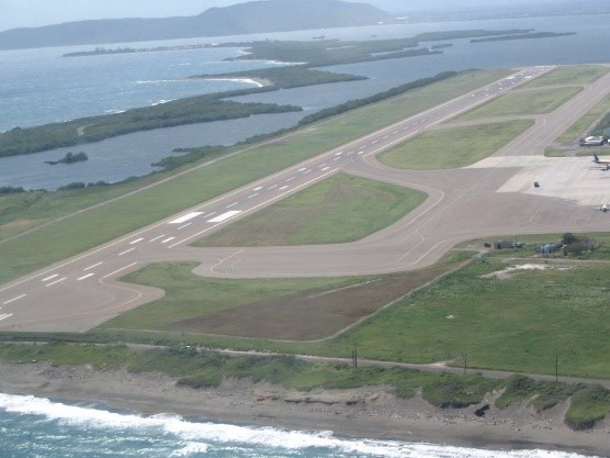
The Caribbean Sea shoreline at the southern end of The Norman Manley International Airport (NMIA) Runway is vulnerable to extreme hurricane waves, long term coastal erosion from sea level rise and short-term storm events. The shoreline is associated with the Port Royal main road and end of runway 12. The Norman Manley highway is the only thoroughfare which connects the Port Royal community, commercial and institutional activities along in proximity to the airport to the main land. Observations and predictions suggest that 30 to 60 meters of shoreline can be lost in a single event and clearly suggest that both the road and end of runway are vulnerable. It is therefore desirous to protect the stretch of shoreline to secure both the airport, access for the residents of Port Royal, other stakeholders and critical infrastructures. A hazard assessment, vulnerability assessment, coastal and structural designs were conducted.
